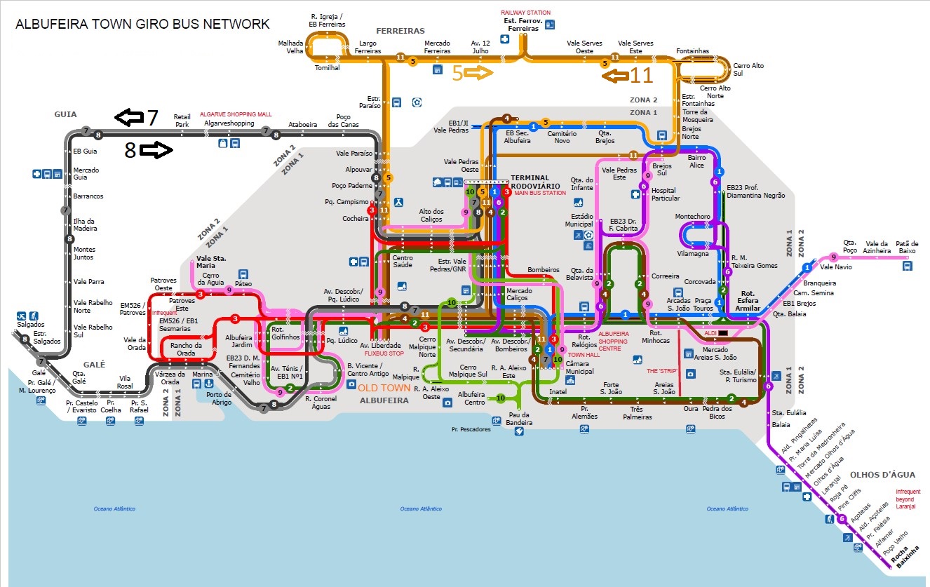
Below is a reduced size version of the Albufeira
Giro route map current as of the date above.
For the full size map, detailed information and links to
timetables for Giro buses click or tap here. Will open in a new
window or tab.
For my bus and train map of the whole Algarve
region, please click here.
The regional bus company website at www.vamusalgarve.pt
has maps of individual routes with all stops marked.
The diagram below shows all the routes operated by
VAMUS linking Albufeira with nearby towns and villages and all the
stops in the town of Albufeira.
VAMUS bus 51 (Linha Littoral to / from Portimão and Lagos) stops
at the Bus Station and also at the Vale Paraiso stop outside the
retail park and trading estate,
The fast buses on routes 56 (Aerobus) and 57 (Transrápido) only
stop at the Bus Station, which is about 1 mile (1.6km) from the
town centre.
All VAMUS regional buses except the number 28 bus
to/from Messines (purple) start or end their journeys at the Bus
Station.
These buses do NOT go down into the old town centre, which is
1.6km/1 mile from the Bus Station.
click to see larger size
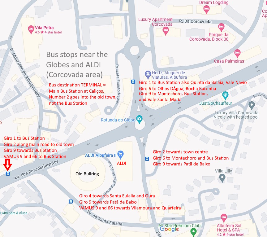
Details of all bus stops near the old bullring and
Corcovada area here.
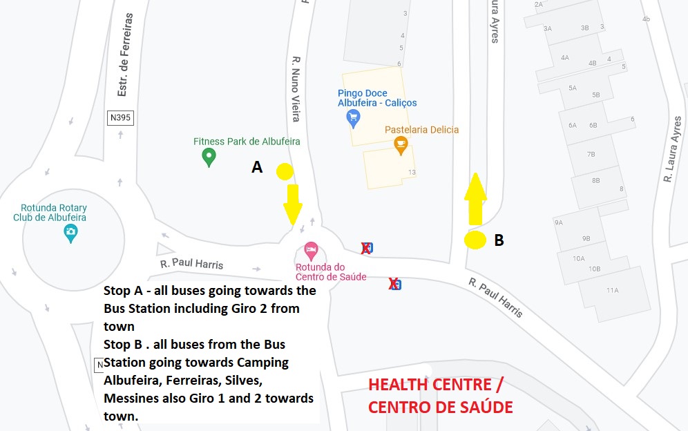
Details of all bus stops near the Health Centre here
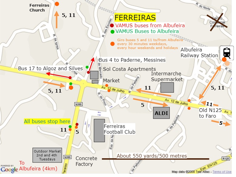
Details of all bus stops in Ferreiras here
Large map of old town showing different bus stops
and other transport information here.
A map of Albufeira showing the main roads, roundabouts and the
different areas, click here.
For a good interactive map of the Albufeira town
area, click here.
Back to the Albufeira bus page here
For a list of all the timetables on the site,
click here
For an alphabetical list of places in the Algarve, click here
For some important general notes about buses in the Algarve, click
here
Back to the main page here